Special Publication:
Barnet Enclosure Map, 1818
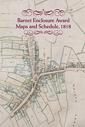
This map, and schedule that accompanies it, were the result of parliamentary enclosure of open fields, commons and waste in and around the old town of Chipping (or High) Barnet and the then village of East Barnet. The Enclosure Acts were to change the face of England and Wales for ever, seeing the final end in many areas of surviving remnants of the medieval open or three field system.
The first wave of enclosures took place between about 1755 and 1780, mainly in the English midlands and in some of the northern counties. The second traunch took place between the 1790s and the mid-1830s, peaking during the Napoleonic wars, at which the time the Barnet enclosure map and schedule were produced in 1818.
Enclosure in or near towns was done for different reasons to that in rural areas, being seen in some cases as a prelude towards the sale of land for later development, as well as a means of preserving open spaces (especially in London). By doing so, owners also effectively abolished the right of use of most common land for grazing, etc. The use of enclosure awards and maps was well developed by the time the Barnet award was made, and their accuracy and authority makes them both of historical and social significance. Then, as today, they are sometimes used to settle ownership or boundary disputes by the courts. As with the Barnet example, map and schedule were often bound in book form, and after being made available for public inspection, were deposited amongst the parish records.
The mapping was done by a competent Surveyor, appointed by the parliamentary commissioners, and a schedule produced in which the new 'allotments' (land awarded by the commissioners) were recorded. The area of the plot was never put on the map, only its reference number, and buildings were not mentioned as they were, for example, on the returns accompanying parish tithe maps a few years later. However, the built up areas, roads, etc. are all carefully plotted on the Barnet map with an accuracy that must have been the envy of the early Ordnance Survey cartographers.
The schedule lists a series of individually numbered plots, with the names of the owner(s) and/or tenant(s), the area of the allotment cited (in acres, roods and perches) and stating who was liable for the maintenance and upkeep of fences, walls, etc. - usually the new proprietors and their heirs or assigns. It will be seen from the Barnet schedule that some of the allotments were to organisations or institutions, including the University of Glasgow (704); Dutch Church, Austin Friars (721); Trustees of the Poor of Chipping Barnet (716); and the Governors of Poor Widows and Children of Clergymen (824). This Barnet map and schedule are a model of their kind, the like of which is rare in Hertfordshire terms. With additional historical notes and a name index, it will be of interest and value to those working in both local and in wider contexts.
£5
(+£4 p&p )